The Gibb River Road…a favorite adventure! Each day a new experience.
There’s something about the outback for me. It’s not the most beautiful landscape I’ve ever seen, but it feels so raw and free. I love it. That being said, sometimes it was a little scary traveling out here alone. I had to dig to soothe myself at times, which is all part of the fun believe it or not.
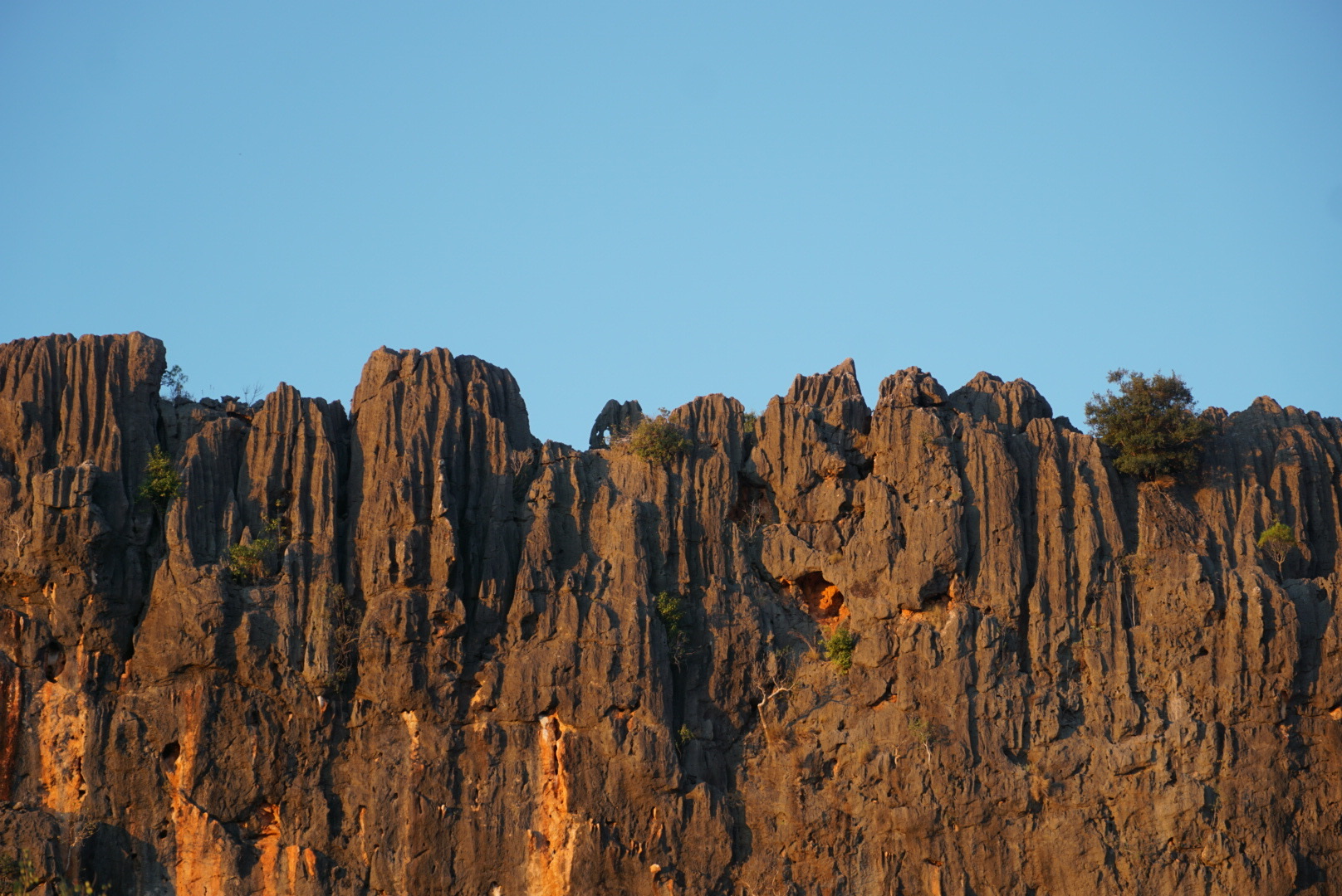
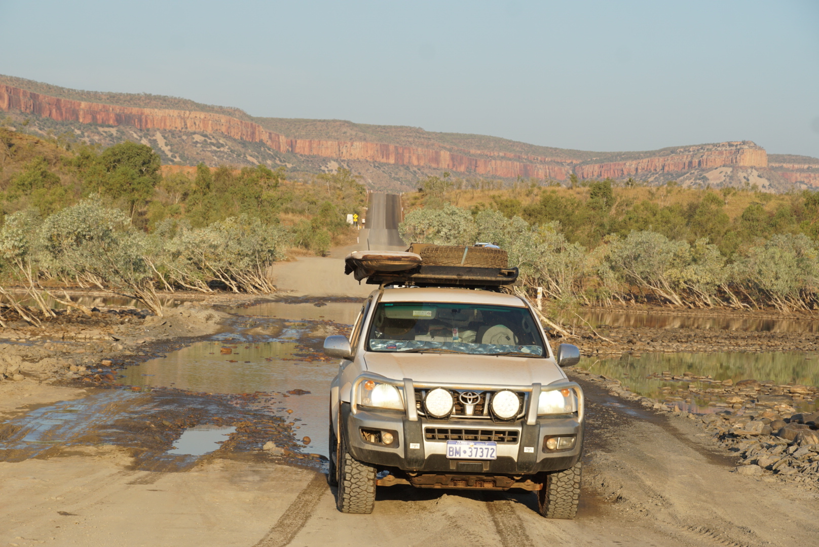
As mentioned in my last entry, the Gibb is a famous 4WD track here in Australia and a part of this trip that I was really looking forward to upon my return here. It’s approximately 400 plus miles of corrugated road with side tracks leading to cattle stations, free camps, water holes, hikes, and more. It’s a remote but well traveled road in the heart of the Kimberley Region. A region known for its vibrant colors, rich Aboriginal culture, and ancient rock formations amongst other things. And I felt fully immersed in all of its beauty during my journey along the old dusty trail.
It’s funny trying to figure out who to trust when preparing for something like this- I had the same experience on my last trip here. One person says, “Ah, it’s just a bit of dirt, you’ll be right”, while another warns it’s tough on you car and things will go wrong. Then someone else says they did it solo with no issues, and another insists it’s a remote, serious 4WD track and you shouldn’t go alone, “you need a snorkel” blah blah blah. After doing some reading and talking with a few different friends, I gathered the opinion that it is overhyped. Most of my fears about taking this road pretty much all circled back to finances or destroying my car, thus keeping me from making it to the Great Barrier Reef and surfing along the east coast. But my biggest fear was all the water crossings I knew I would encounter. I know my car is perfectly capable of water crossings, it’s just my lack of experience & the unknown that had me nervous. I really have to thank my friends Ann & John who gave me so much great advice and guidance!
As the day grew closer to leaving Broome, I was feeling anxious for a number of reasons. The time had finally come when I was taking my first step towards leaving Western Australia…something I have dreaded since arriving there. I was saying goodbye to some new friends in Broome who I really like to go be alone in the desert. Hah. And of course the thought of something going wrong, as I just mentioned above. I know I’m making this sound like I wasn’t excited at all, but I was! It was that nervous excitement you know? The perfect mix of fear and excitement. I don’t think the fear is a negative thing, I think it makes things more interesting and is necessary in giving me the feeling of overcoming something. After a comprehensive shopping spree I had enough food for about 3 weeks, enough water for a few days at least, and a full tank of fuel. You can refill water tanks at camps along the Gibb and there are a few cattle stations that have fuel, but there aren’t any real grocery shops (at least not that you can rely on).
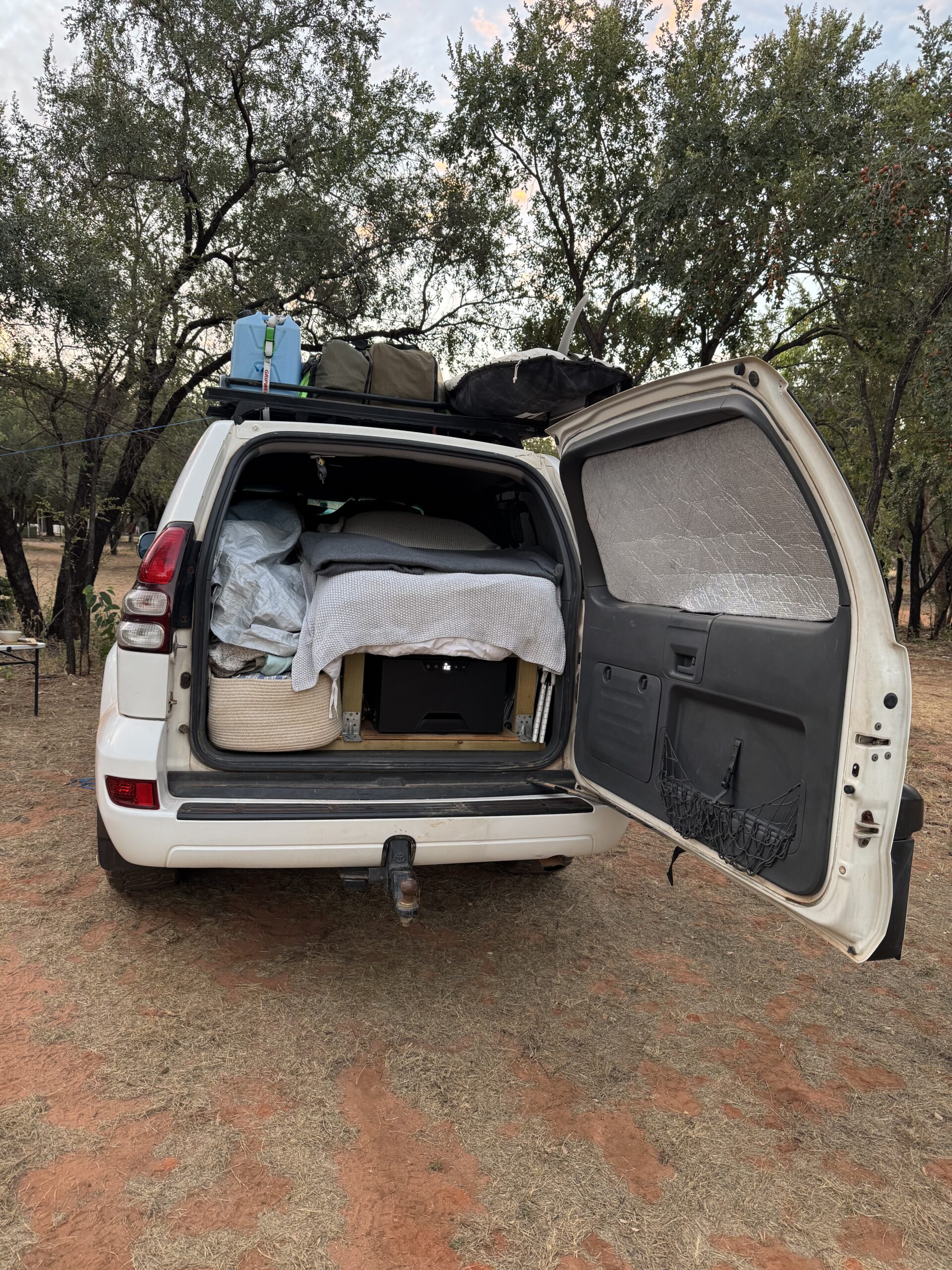
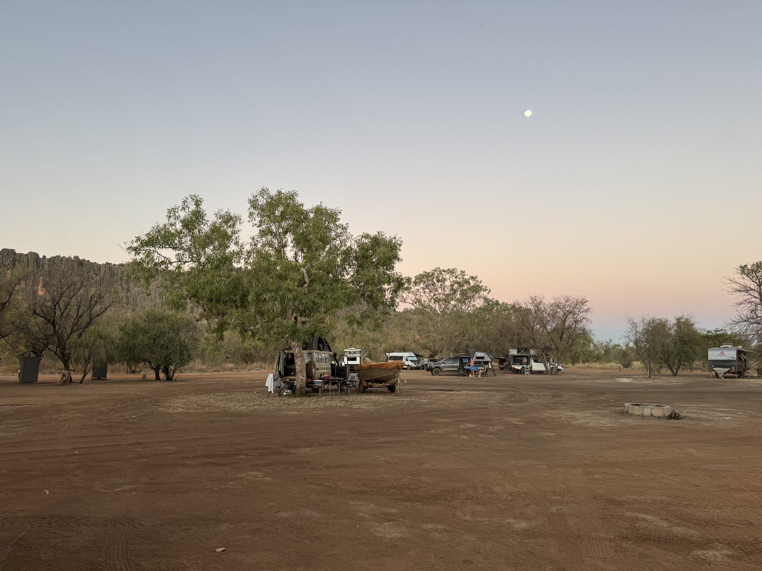
It felt bitter sweet driving away from Broome knowing that I wouldn’t be going back this time. My first night back to camping out of my car was only a few hours up the road, just before the start of the Gibb. I wasn’t sure how it would feel to sleep in my car again after being so comfortable all year and sort of forgetting what it felt like to be so minimal. Well, it was amazing! As soon as I got set up and started cooking I was so happy. Here I was again, doing all the things I would normally do inside, but out in the open. It’s a very freeing feeling.
Come morning time I was ready to begin the Gibb! Here we go. When I got to the beginning of the corrugated road I pulled over to let my tire pressure down. I remember the first truck (ute) I saw that came barreling down the road towards me with all the dust floating in the air behind it. It gave me a jolt of excitement! Off roading really excites me even though I’ve never really done it until coming to Australia. I think the excitement comes from the fun memories of going 4 wheeling on the weekends with my dad and the neighborhood gang growing up. It’s like an evolved version of that I guess.
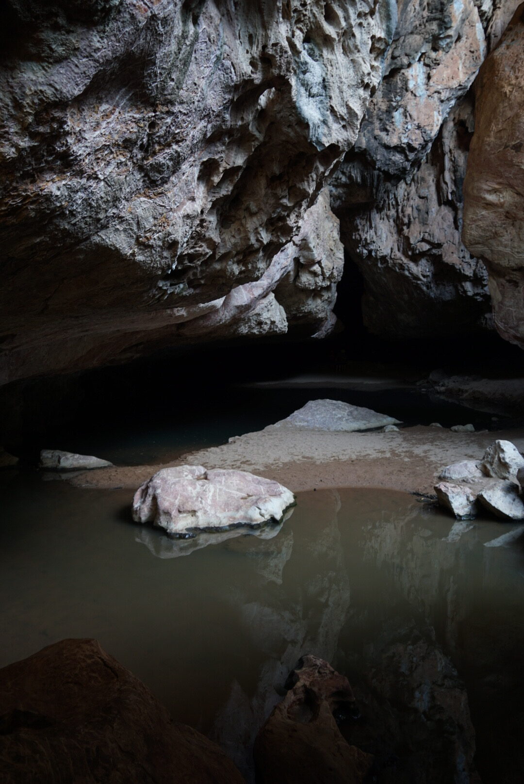
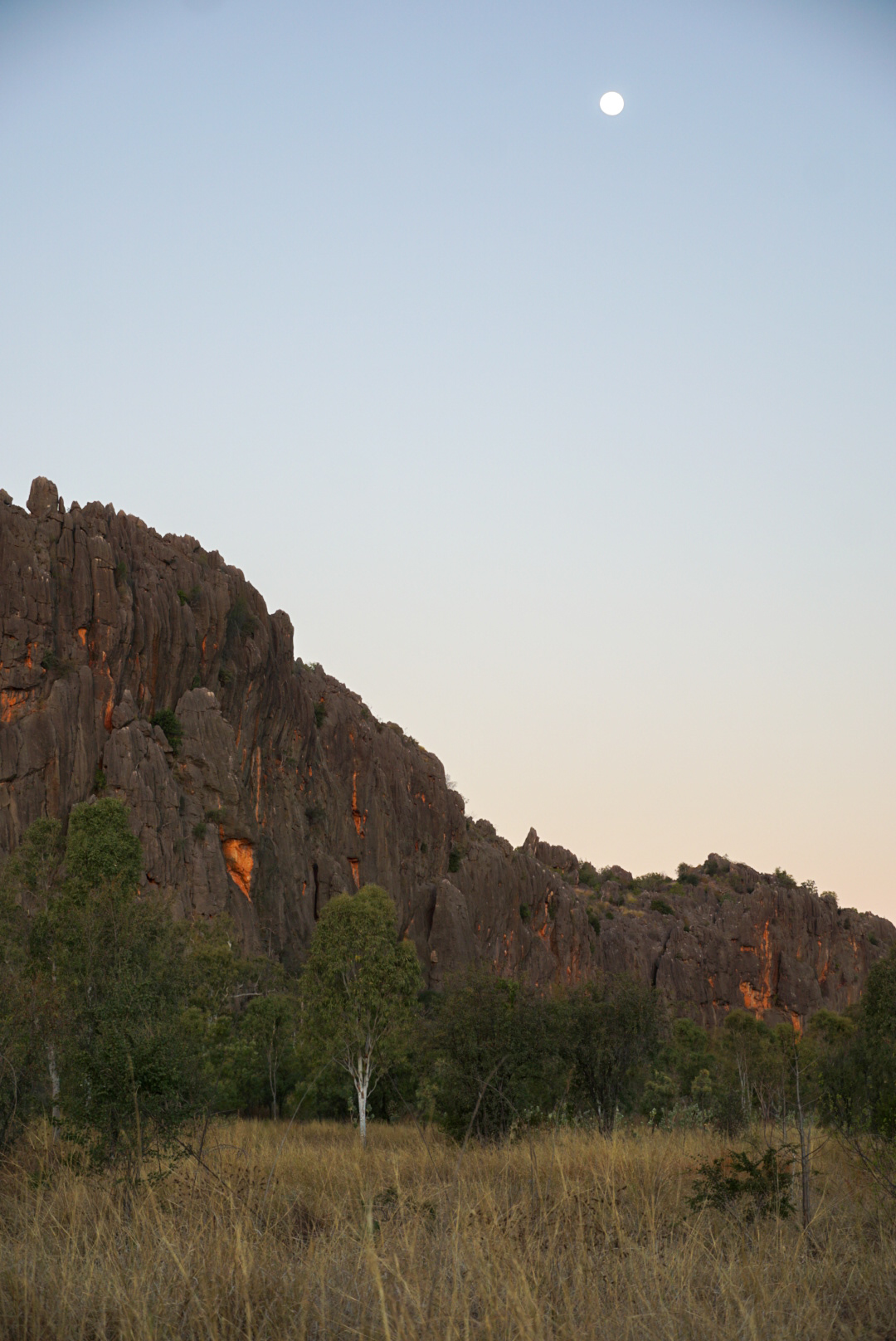
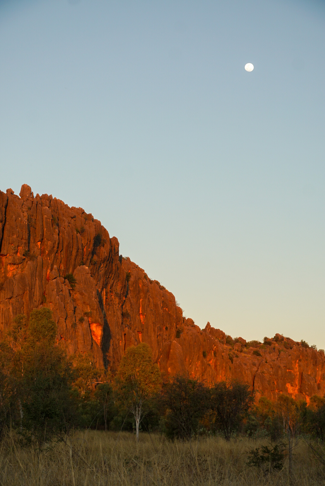
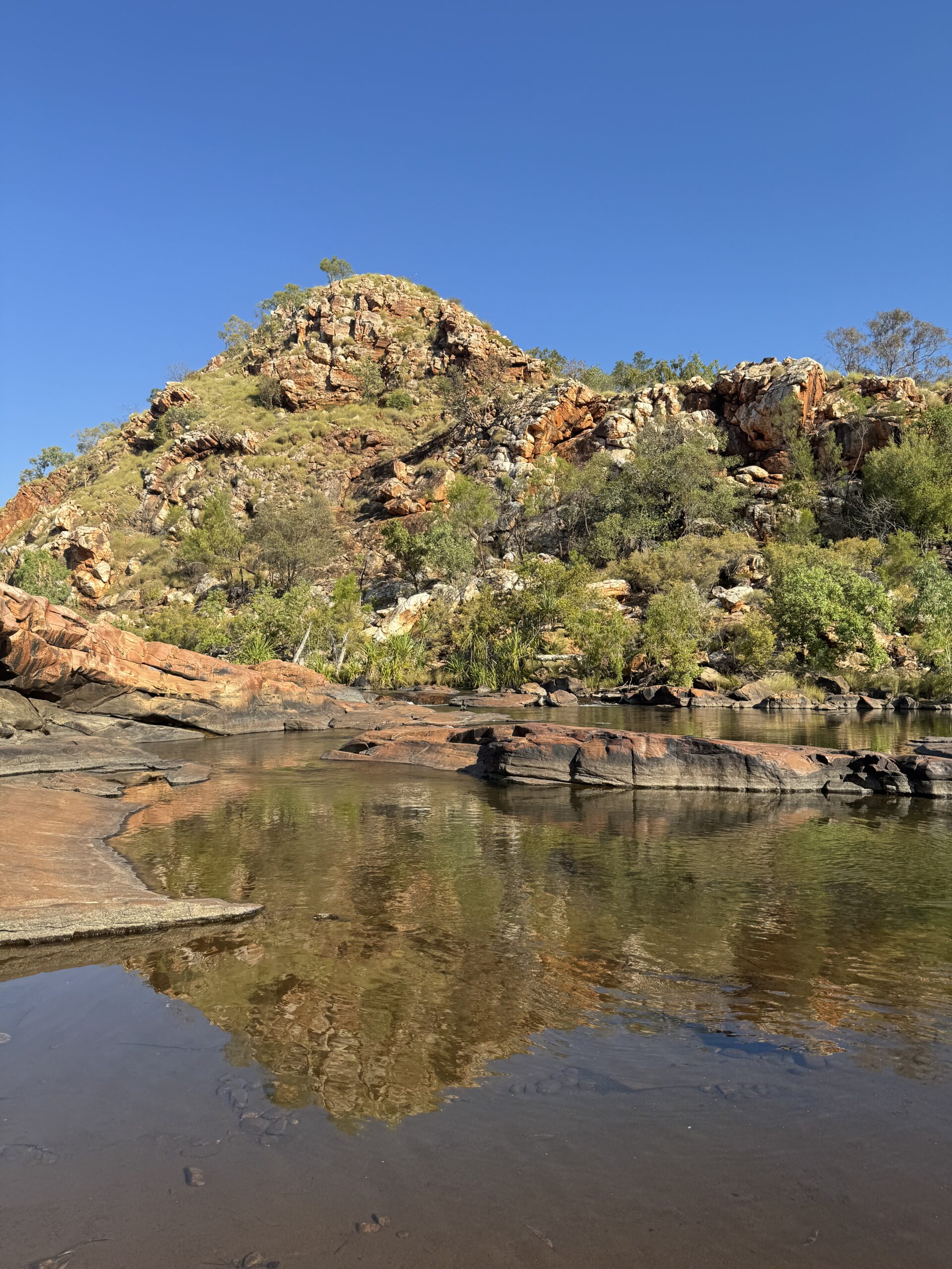
This first section of the road was pretty rough although not as bad as I was expecting. It had some sections of pretty deep corrugations and big rocks. I would soon come to find out that this was one of the roughest sections of the whole road. At the time I didn’t know that and I thought it could/would get worse. What a pleasant surprise! I would also later discover that this was one of the most beautiful sections of the road. I was pretty blown away by the beauty of the rocky range that was the backdrop of this section- the Napier Range. This segment of the road leads to a place called Tunnel Creek- a limestone cave which you can navigate from one end to the other. I was really looking forward to this, but it was even cooler than I had expected! To get into the tunnel, you have to crawl through an opening in these beautiful limestone rocks and when you get inside, the light shining through the various openings in the cave was stunning. Flash light (torch) in hand, I walked through the tunnel to the other side…there are sections of this walk where you have to walk and even wade through water. Honestly, that was pretty freaky because freshwater crocodiles live in there and I really couldn’t see much of anything in the deepest section, which was above my waist. I was told: just don’t step on a crocodile and you’ll be right. Ok then. I knew I was safe (pretty safe)….I mean it’s a National Park after all and people bring their kids in there and tour companies run a trip there, etc. But, I definitely had a moment of pretty intense discomfort while wading through the deepest section of the water in the pitch dark, which happened to be one of the few times there wasn’t anyone else around. Just outside the end of the cave there is a little creek bed, and right around the corner I saw my first bit of Aboriginal rock art for this trip. To complete the adventure, you go back the same way you came through. I was happy to walk through the cave again although it wasn’t quite as thrilling the second time around since I knew what to expect. But I took my time to really take in the beauty and uniqueness of it. My campsite for that night was pretty close by and I made it just in time for a short walk through the bush during sunset. It was a full moon and it was gorgeous as the light faded, changing the appearance of the rocks as the sun went down and the moon rose. It was a great first day!
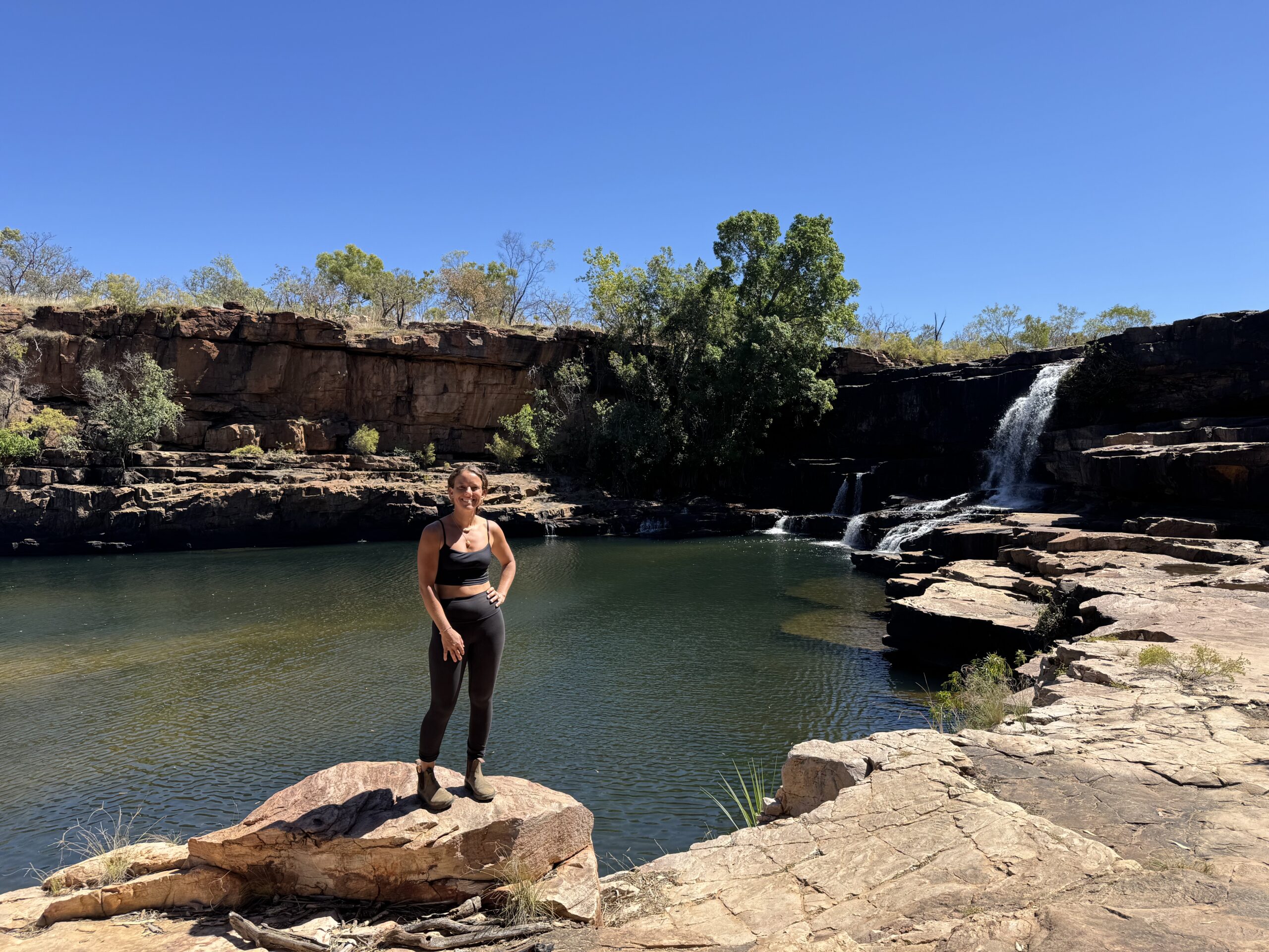
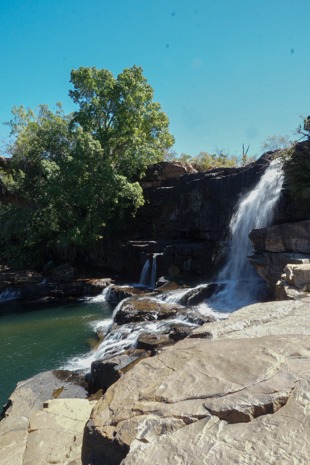
The following morning I was up at sunrise to do a walk through the gorge at my camp before continuing on down the road. I was feeling a boost in confidence after a successful first day of driving, but I knew I was really barely at the start of the road and I didn’t really know what to expect as the road went on. It was a few hours drive to my next destination- Bell Gorge, the first of many gorges with hikes to beautiful swimming holes and waterfalls. Each unique. It was along this section of road that I encountered my first seven water crossings. None were deep but a couple were a bit muddy. As expected, once I went through the first couple my nerves subsided and I was having a blast! I had a glorious swim after a long day of hiking and driving. I remember feeling a very heightened sense of peace at this water hole next to the trickling water and beautiful rocks. I also remember thinking that a beer has never tasted so good when I had set up camp.
On day three I was off to the next gorge deeper along the track. I started to note an interesting routine of feelings. Each day I would wake up with a certain amount of anxiety for what lay ahead, which quickly turned into extreme happiness and excitement as I began to move along and then each of my days would finish with of a feeling of accomplishment and comfort. I leaned into it. There were plenty of people around at all times, so I had some confidence in knowing that if I got myself into any kind of trouble someone would help me. I didn’t have any cell reception though, so I was relying entirely with what i had on hand, and I realized once it was too late that the maps and wiki camps itinerary I had tried to download didn’t do so properly. Once again, Ann and John coming in clutch with a handwritten map of the road complete with tips and approximate distances that I had brought with me.
One of the next gorges was probably the most popular along the whole road. It had the first fuel station of the track so far and a massive campground nestled up next to a river which you had to swim across to take a fairly long hike to get to a gorge with a large and deep swimming hole, complete with a few waterfalls to jump from. I spent an afternoon here swimming, jumping from the falls, and warming up on the rocks with my friend from the road. It was like this happening place in the middle of the desert. There was so much fun energy there. This sort of felt like the peak of the road. I spent a couple of nights at this camp and my decision not to fuel up here changed the course of the rest of the journey along the track for me.
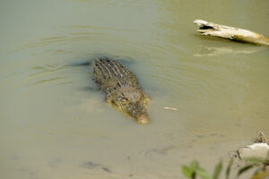
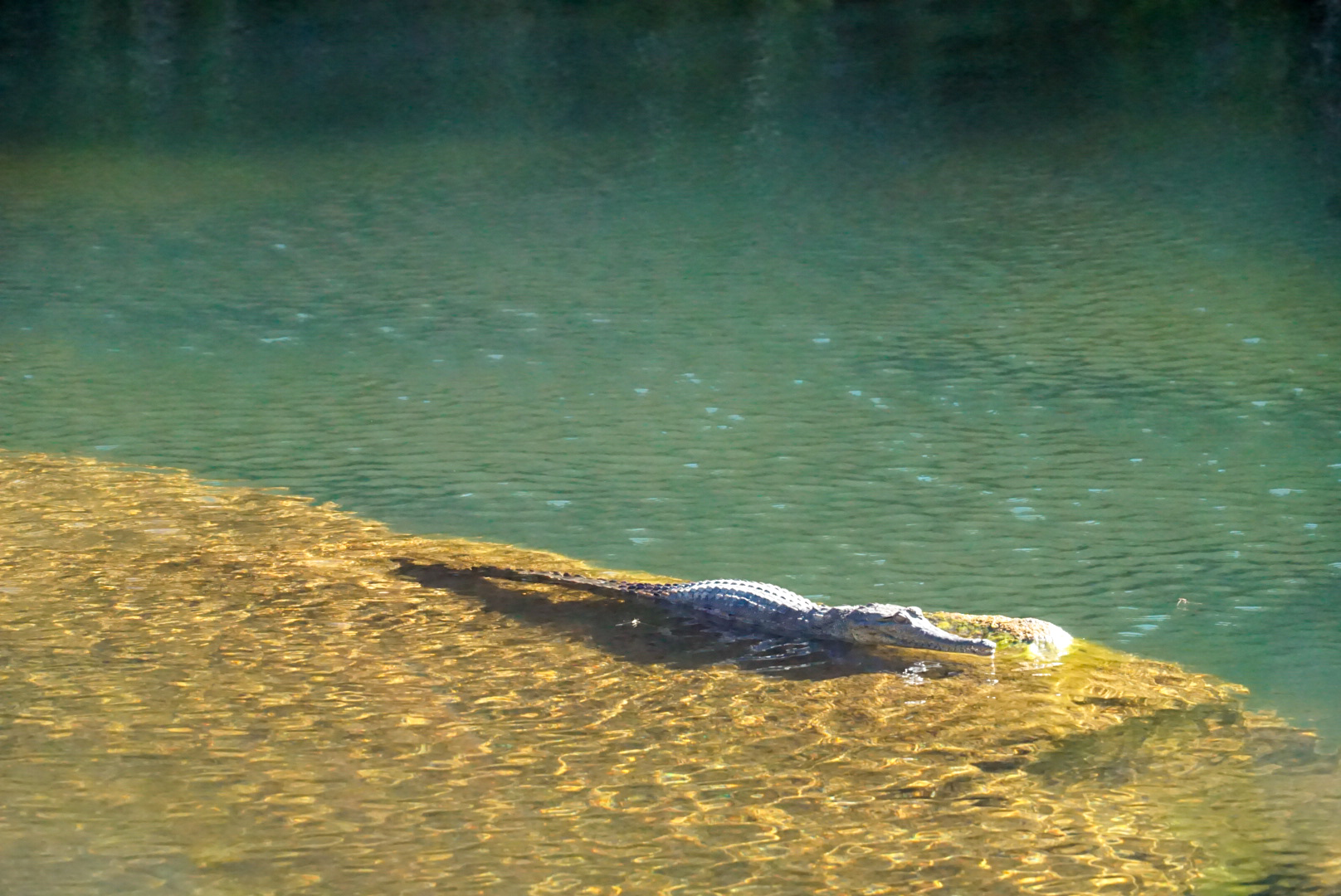
By this time I had started to be in the presence of the same people each stop I made and so I had a group of friends who were naturally on the same itinerary. There were a couple of different families with similar aged kids in tow, and a few friends traveling together who are around the same age as me. We were all moving on to the next cattle station along the way called Mt. Elizabeth, which I considered skipping especially after first pulling in. The only reason I stayed was because someone who knows the road well told me it was one of the coolest spots. It didn’t look like it at first glance. In fact, if it wasn’t so late in the afternoon I may have taken off. What I eventually discovered is that this cattle station had some real hidden gems that were more of a mission to reach. Which is why it seemed like such a ghost town when I first arrived…everyone was out adventuring. It is the most remote of the stations on the road I think. This became my favorite stop. It was here that I saw my most favorite aboriginal rock art, saw my first freshwater crocodile (right next to where I had been swimming), and had the best burger of my trip. To make a long story somewhat short, I spent two nights at this station and then began to leave to head on down the road with the group of people that I’d become friends with. I was a little bummed that I didn’t go down to the main water hole because it was a pretty intense 4WD track which takes about an hour and a half to drive approximately six miles. I wasn’t feeling confident about it and so I decided to skip it…even after hearing about how nice it was down there.
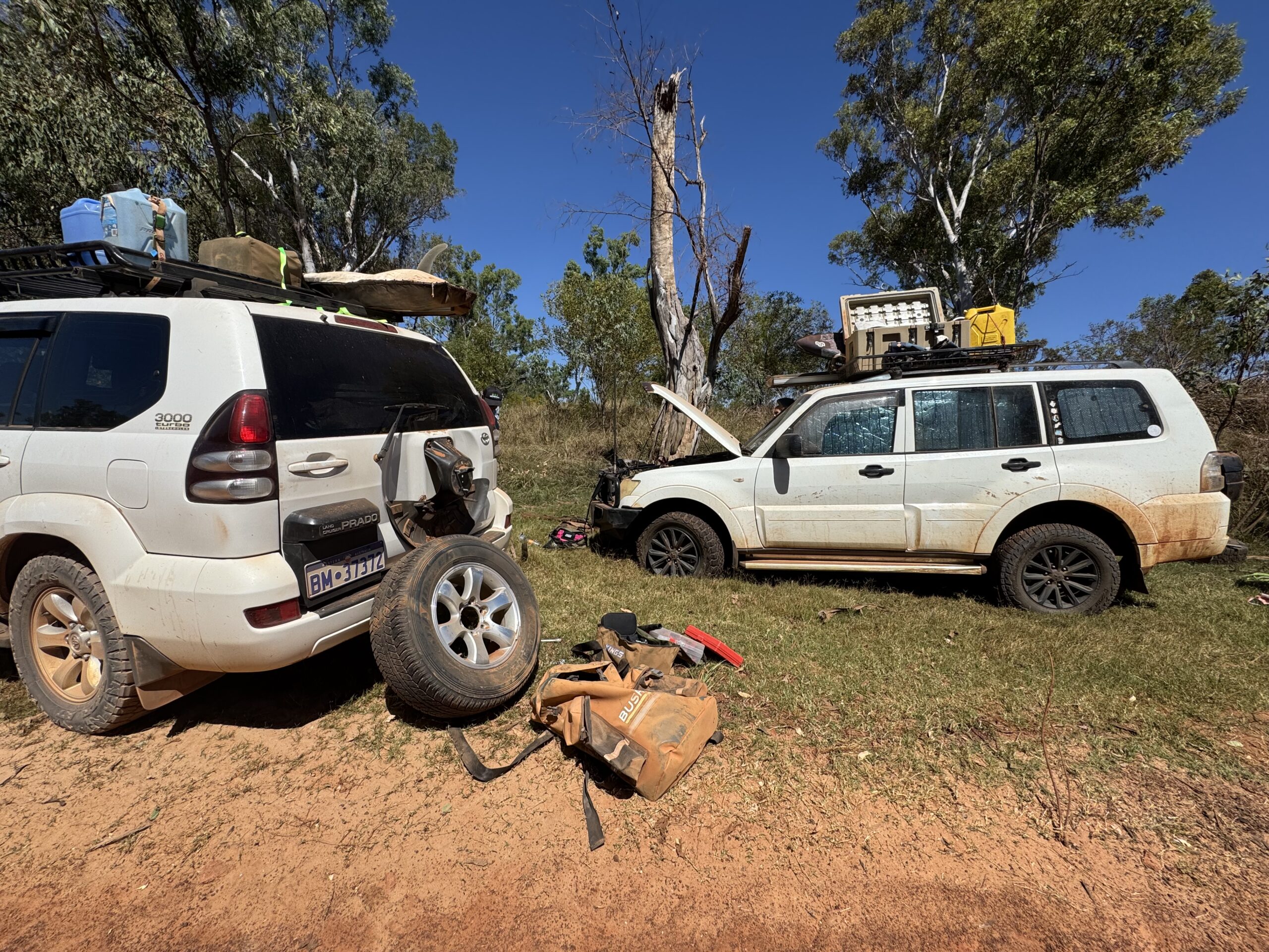
Just as I was about to leave, I was informed that one of the girls that I’d met along the road decided to drive around dusk the night before and came up too fast on a little water crossing that had a couple of big holes under the water and blew three of her tires all at once. Whoops! And, she only had one spare tire. So I drove to meet her and lend her my spares. It took a few of us in the hot sun to finagle some things around until she was up and running. We were about 2 hours away, heading in the opposite direction from the only tire repair shop on the road. It was already pretty late in the afternoon and she wouldn’t make it there and back before dark. So me and everyone who’d been sort of traveling along together set up camp for the night there at the little free camp on the river. Only about 45 minutes from the station we’d just left. This is when i learned about the aboriginal art that I had missed out on at the water hole I didn’t go to. I decided that I had to go back the next day and see it or I would regret it. That night we watched a thriller movie in the middle of the bush on a portable projector one of the families had with them.
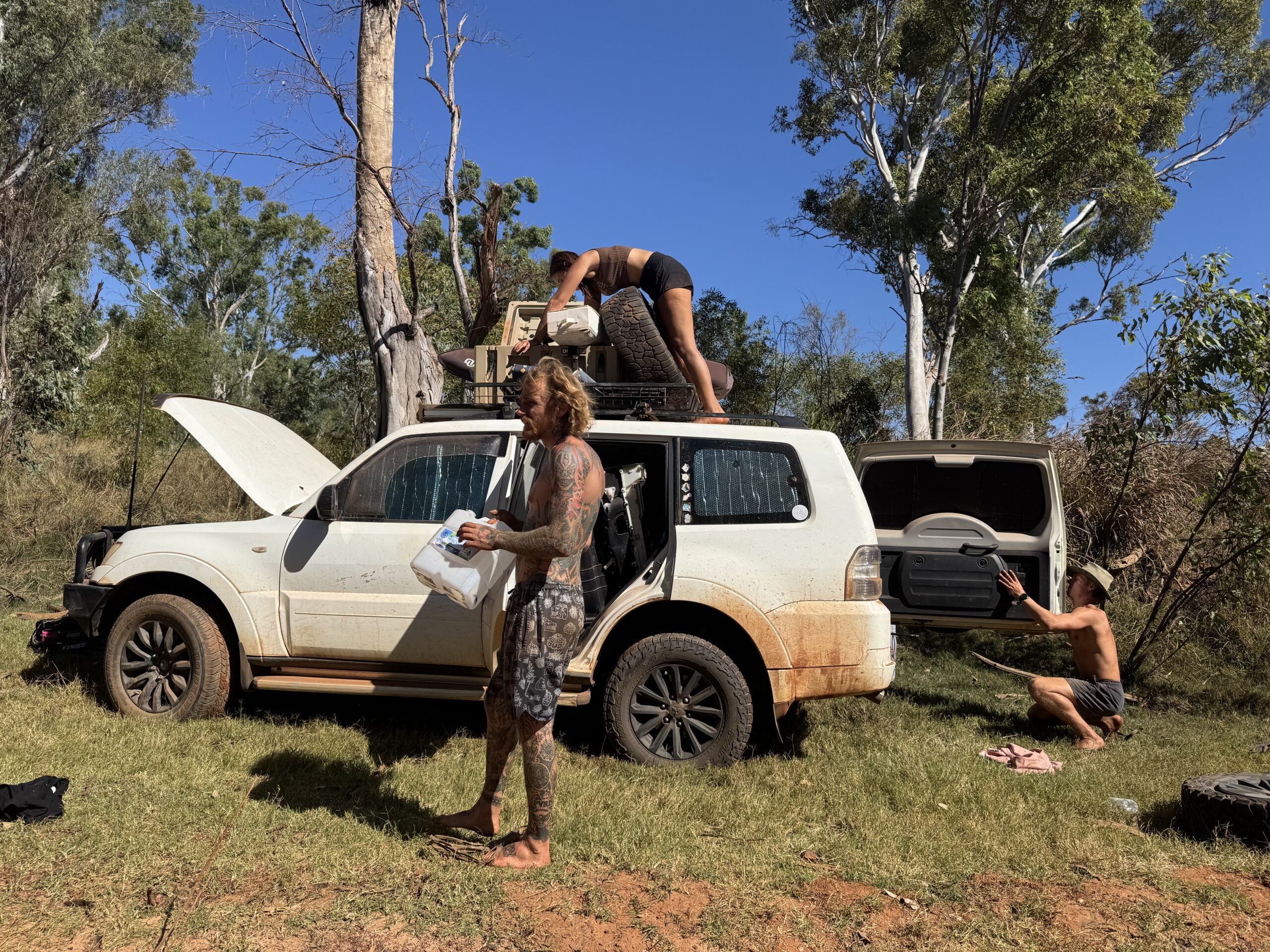
It wasnt until very late morning the next day when Jasmine came back with her tires replaced/repaired to return the spare me and another family had lent her. Which kind of ruined my plan to rush back to that water hole to find the aboriginal art and then catch back up with my friends. But, that was an unrealistic plan anyways so it’s ok. It ended up taking me two visits to that water hole to be able to find the artwork. I had vague instructions, but once down there it was harder than I thought it would be to know where to look. The first day I walked down there from camp, which took me about 3 hours one way and made for a very exhausting and interesting day. The second day I hitched a ride with someone and was able to find it. For my taste, it was the coolest rock art I could hope to see and in a more raw environment than some I’d seen before with signage and blockades. It was worth every ounce of effort to see it and I finally felt satisfied! The only bummer was that now I’d fallen way behind my friends and now knew no one again. But, still worth it and after spending an additional three nights here I was more than ready to hit the road again.
I made it to a free camp on the river where there is a fork in the road. One direction leads towards the end of the track and the other leads to the coast and an iconic and significant Aboriginal landmark known as Mitchell Falls. This adds a significant distance to the road and is known to wreak the most havoc upon vehicles. I wasn’t planning to go up there. But, there was also another station with fuel a little over an hour up that road, and with all the back tracking I had just done I wasn’t so sure I would make it to the next fuel station along my originally intended route. A neighbor at the campground allowed me to hook up to their star link and I learned from my friends who were ahead of me that there was a big fire and the last station along the track had closed and was evacuating people. I didn’t want to rush towards that shit show and so I settled into my idea of driving out of my way to the fuel station I knew I could reach. That night I was feeling bummed about being so alone again, knowing that it was somewhat unlikely that I would catch back up with my friends at this point.
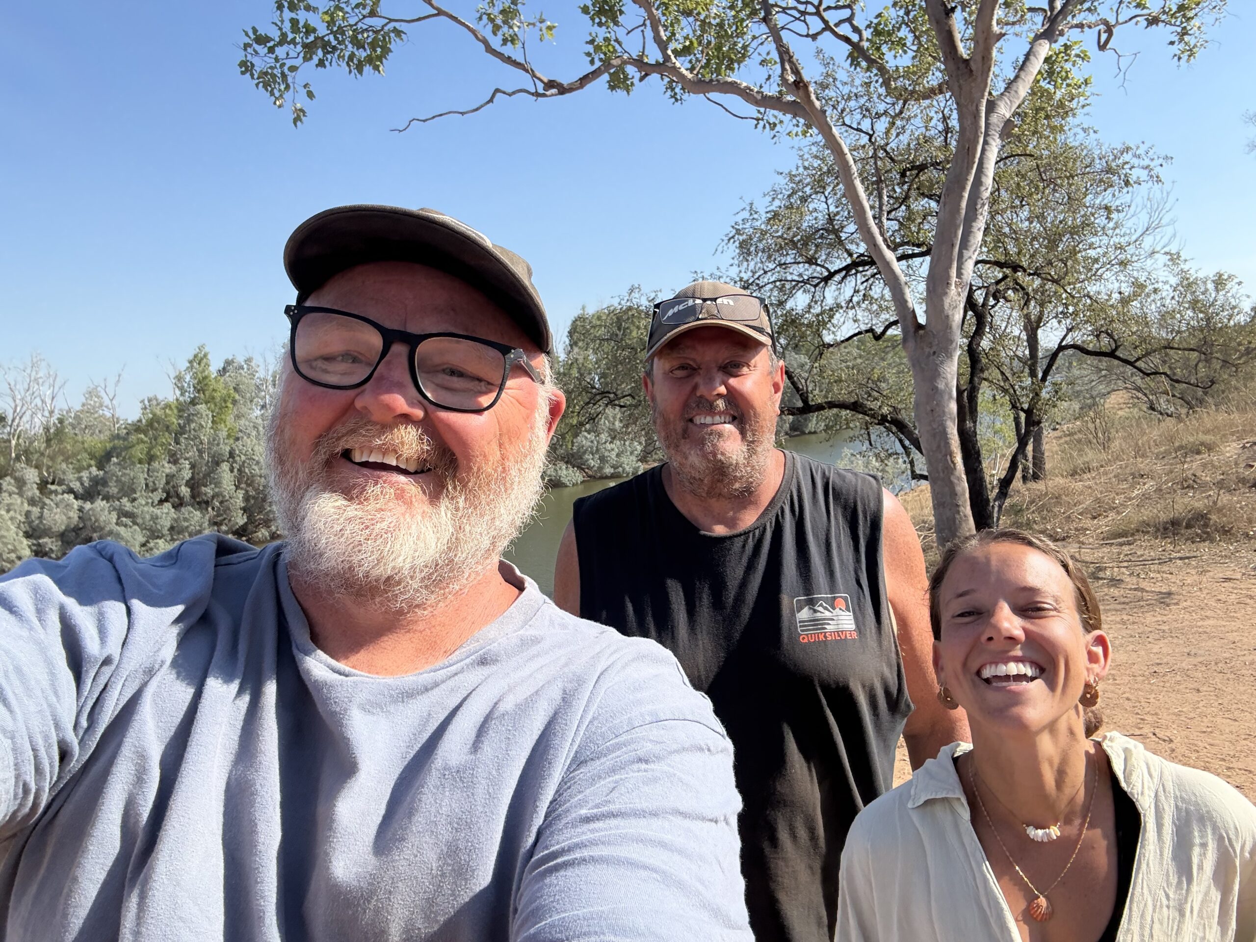
As always, I was up with the sun with the intention of getting to the fuel station right as it opened and then continuing on my way. This little fuel run would take me about three hours out of my way round trip. When I pulled up to the shop it was still closed for another ten minutes or so. I was just behind a couple of middle aged Aussie guys who I recognized from camp the night before. Friends since high school who were doing a big road trip from the east coast. They asked if I was going up to Mitchell Falls. I said it wasn’t in my plan because of how rough I knew the road to be up there. They said well, if you want to follow us up you’re welcome to. Such classic behavior from Australian’s that I have observed during my time here. Always willing to look out for one another. My initial thought was no. But, I had a pocket of service here and was able to check the conditions up the road in the fire zone. It wasn’t looking good. And that was an area I was really looking forward to getting to. So part of me thought- this is perfect. By the time I complete this side mission, a few days will have gone by and maybe the fire will have blown over by then. And the other part of me thought- what about the condition of the road and the extra cost in fuel plus wear and tare on your car for this? It would add an extra 200 miles to my journey…at approximately $12 AUD per gallon or $8 per gallon USD. So, I had to decide. And the risk of something going mehanically wrong with Pradie and having to put it on a truck to get it off the road (I saw it happen to a few vehicles along the way thus far). These Aussie guys had a good vibe about them and there wasn’t much else to see between where I was and the location of the fire. So unless I wanted to leave the adventure all together, this was the better and more fun option. I put in a quick call to my friend John who had supported and guided me through my whole journey to ask his advice. Him and Ann have been up there, so he knew what I would be getting myself into. He said to go for it. Well, no more questions then.
Suddenly I had started a whole new adventure within my adventure! I was nervous because I didn’t really want these guys to feel responsible for me, but I also felt at ease to have a support system that was making it possible for me to reach an area of this country that I originally planned to miss out on. This segment of the road proved to be both not as bad as described but also on par. It was pretty rough in a lot of areas, with very large rocks to constantly avoid, narrow sections through shrub, and sections of really deep corrugations. Also some muddy areas, and just before reaching the security of the campground, the deepest and fairly long water crossing I had encountered so far. However, I think the reputation it gets comes largely from people who drive too fast or carelessly and or have less reliable or looked after vehicles. Or just unlucky circumstances. It was pretty slow going and I was really enjoying myself! I really felt like I was “out there” and I was. But honestly, without out my new friends John and Anthony, I would have been very uncomfortable. At least I knew if something went wrong, I wouldn’t be stranded. To put things into perspective here, this area I was in is about 8 hours away from the closest town of any real significance. It would be all good if I I had unlimited funds, but I don’t. Thus causing my stress if something were to go wrong.
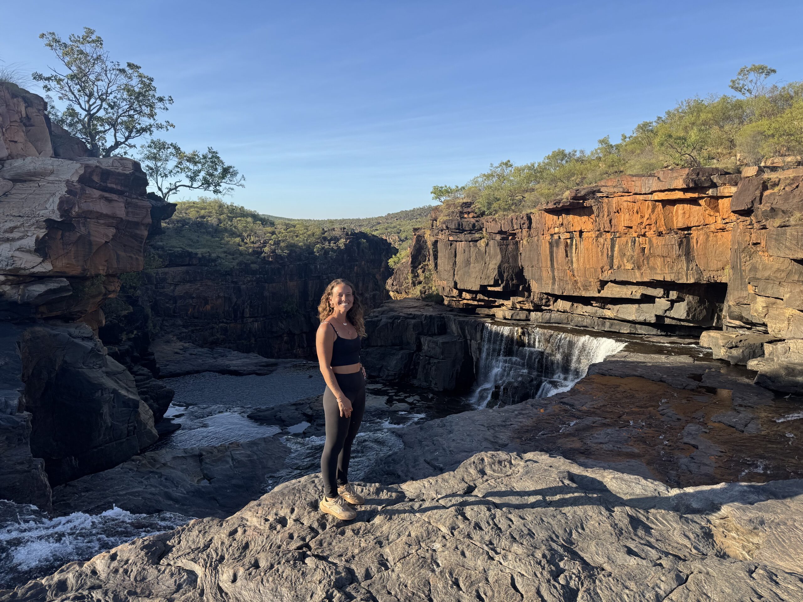
Well, spoiler altert: nothing went wrong! It was a fun and adventurous trip up to a culturally significant and very remote part of WA. Time sort of seemed irrelevant up here. We got a bit lost which led to some impromptu 4WD lessons for me. As for this part of the Gibb, I can say it was more the adventure of it that I liked most over the actual destination. But, I was really amazed by the scenery up there. Insane sunsets with foliage that resembled Florida in some ways. But then big waterfalls and gorges. And a coastline with beautiful beaches and really blue water, inhabited by salt water crocodiles. But, unfortunately I never got to catch a glimpse of one up there…I was really hoping to see one in the ocean.


Once we made it back to the main part of the Gibb, we parted ways and I felt these guys were happy to get rid of me. I was on my own again, only to run into them again down the road the next day haha.
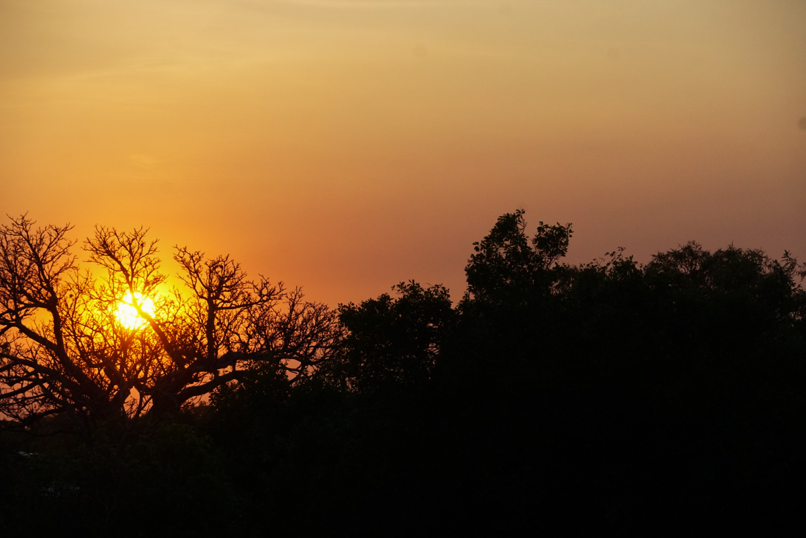
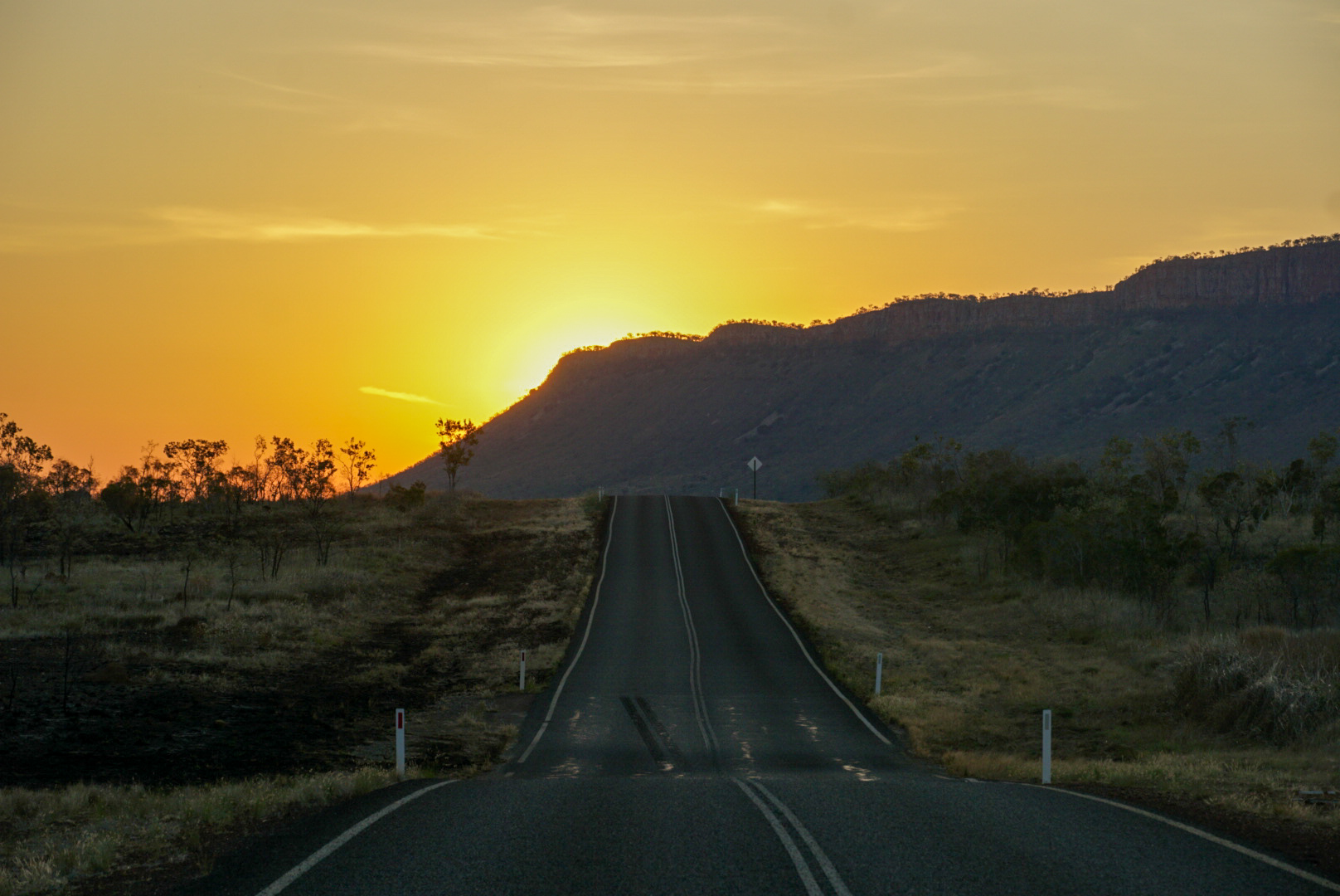
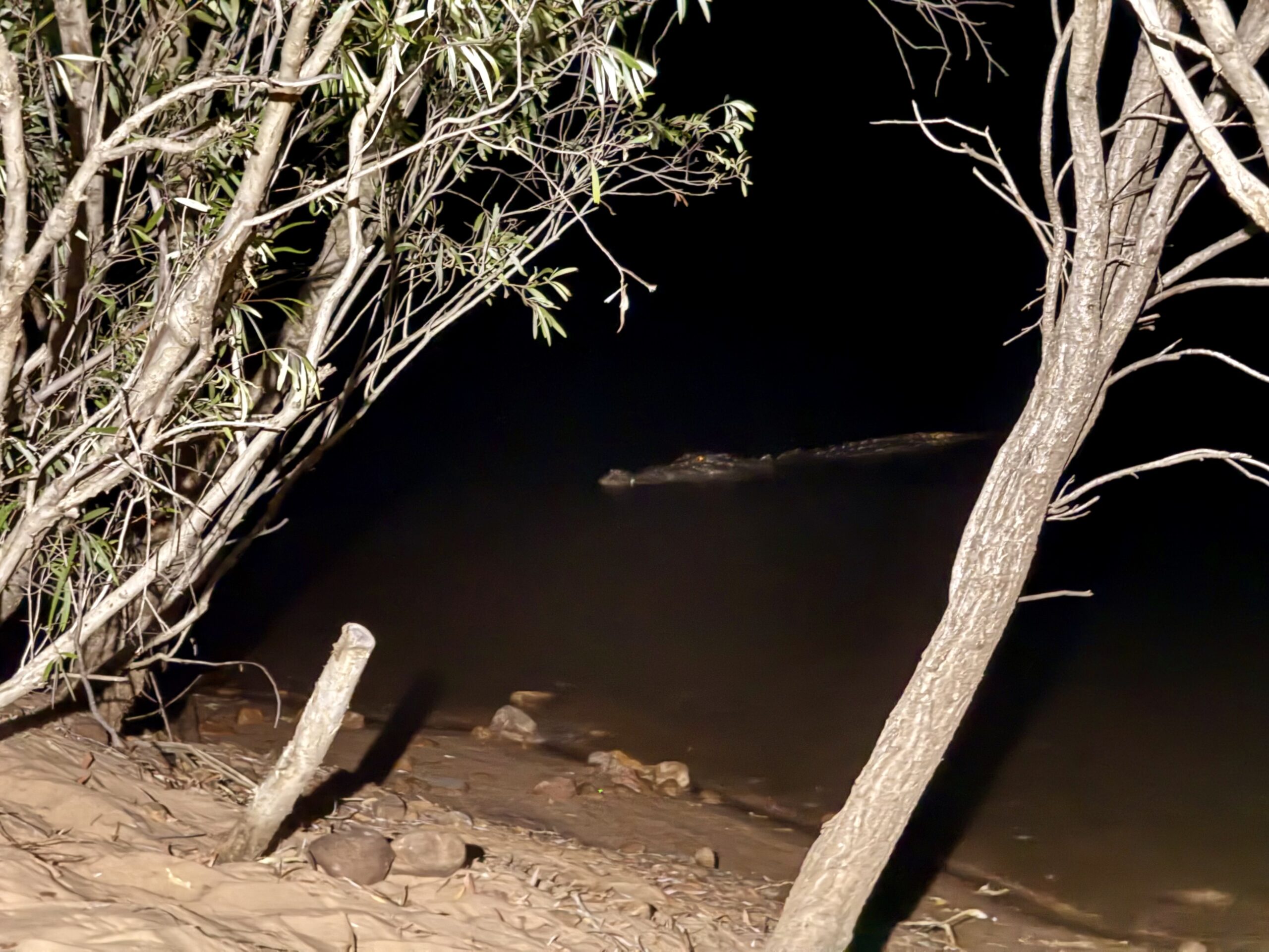
Now I was headed for the last section of the Gibb…the Pentecost River and El Questro Station. The Pentecost River is the most iconic part of the Gibb River Road and a major water crossing when the water level is high. It is also a free camp and this is where I saw my first salt water crocodile, unexpectedly. I thought there were only fresh water crocodiles in this river system and so I was quite surprised and excited to see one here right next to where I was camping! The famous Cockburn Range is the backdrop here and it was particularly beautiful at sunset when the sun was shining directly on the rock faces. I posted up here with John and Anthony while we waited another day for El Questro to reopen following the fires. There wasn’t much to do here except for play many rounds of card games!
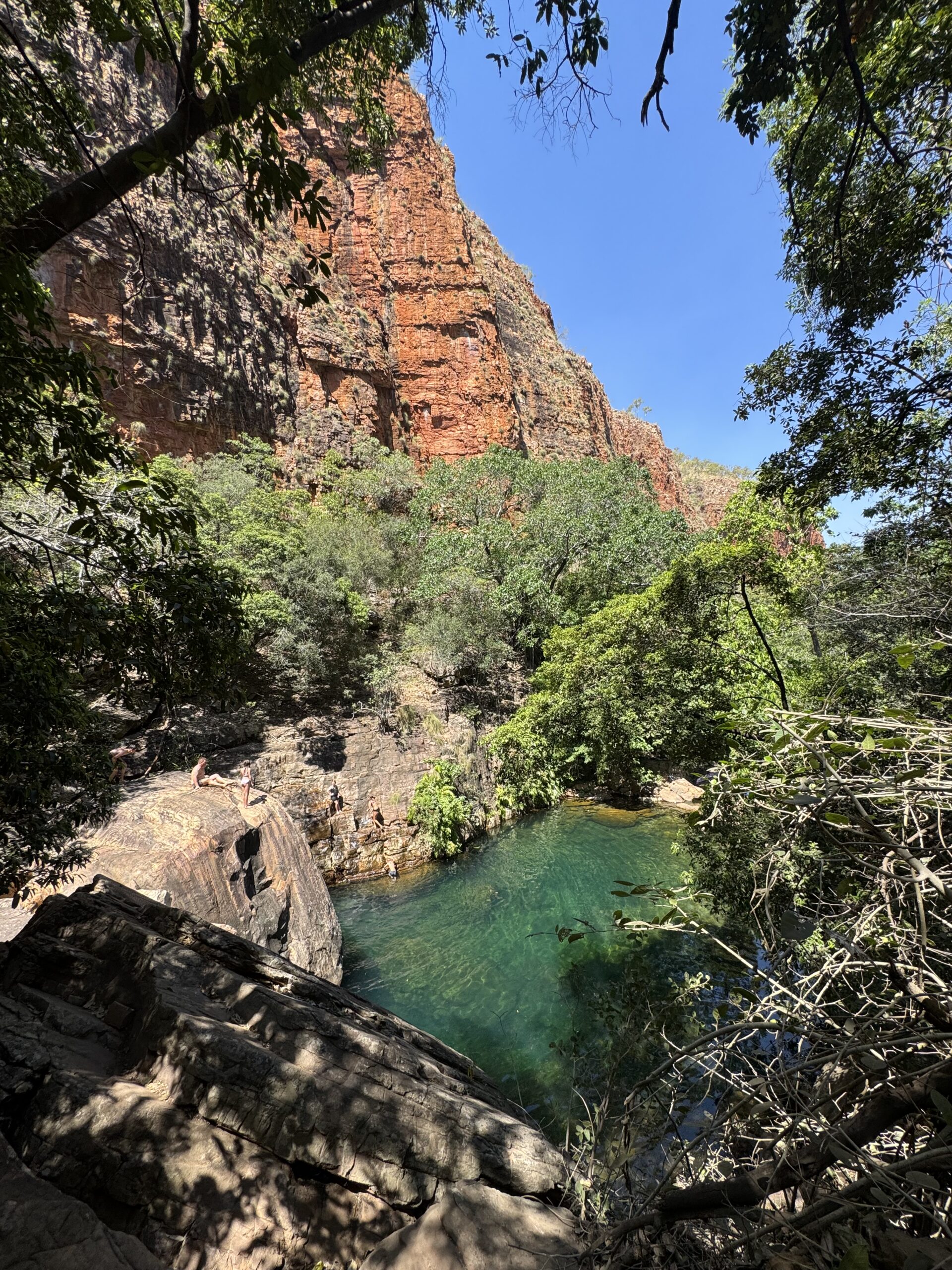
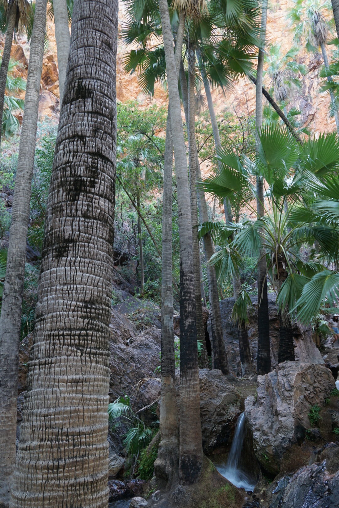
Only one of the gorges opened at first, which ended up being my favorite gorge of all (based purely on the way it looked). I felt like I was in the land of the ferries. The water here was clear and a striking shade of blue especially in contrast to the red cliffs it was tucked up into. I was pretty amazed. I found it interesting that the majority of the landscape while driving along was very dry and desert like, but then when you got up into this gorge it was extremely lush. Like I was suddenly in a tropical oasis. I ended up coming back here a couple more times over the next few days. And the timing worked out in our favor because a lot of people had vacated the area due to the fires and so it was pretty quiet. This part of the Gibb is the most accessible and a bit touristy. After this hike I said goodbye to John and Anthony as they were headed off to another National Park. I ended up staying at the Pentecost for a few more nights as they slowly reopened most of the remaining hikes and gorges in El Questro. I’m really glad I did! It’s a really cool spot with a really lively campground. There are multiple hikes, a few 4WD tracks, a natural hot spring, and the deepest water crossing of the whole track by far. The longest and deepest. I was happy to have had a lot of practice by this point! I was heading back to my car after a very zen experience at the hot springs when I ran into my friend Jodie that I know from when I was living in Broome…it was random and so nice to bump into a familiar face out there. After seeing all there was to see at El Questro, I was feeling very satisfied and ready to leave the Gibb.


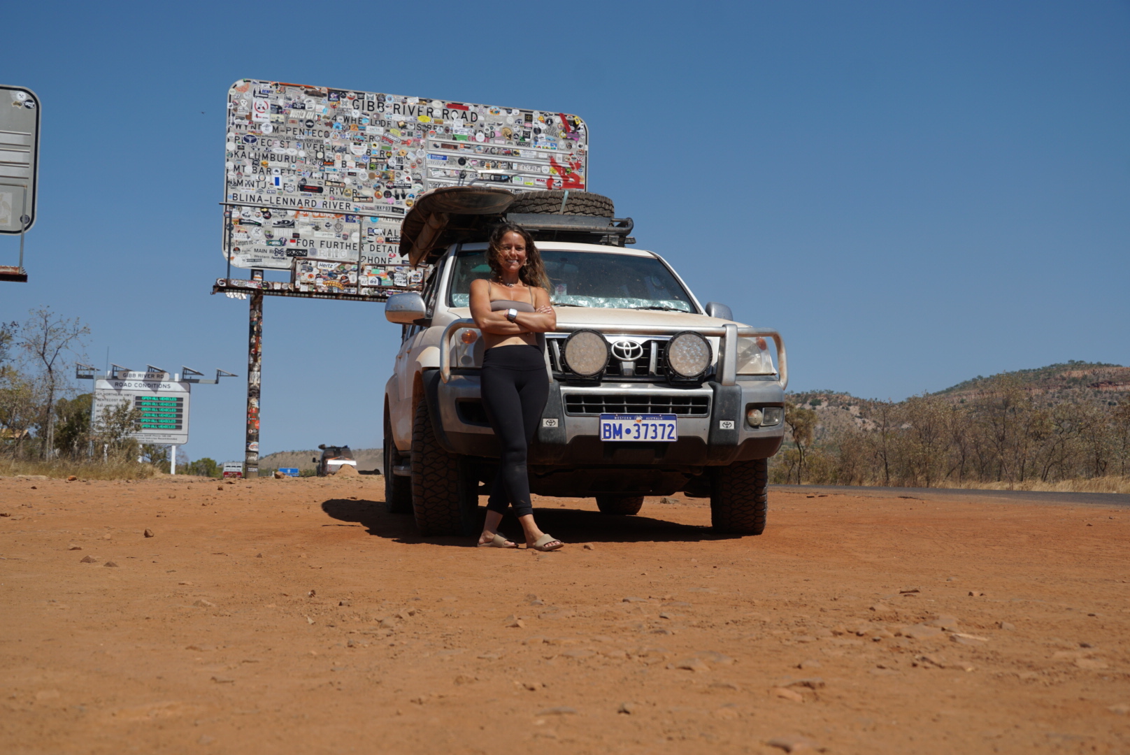
It was a strange feeling driving away. I felt like I was leaving the ultimate adventure land…a place that seemed void of rules. Full of people who just wanted to explore and have fun. And I felt like I was coming down to reality from a high. Like “real” life was boring. I knew that would wear off of course. I stopped when I finally reached the famous Gibb River Road sign, feeling incredibly happy, lucky, and accomplished! I took my time here getting a couple of photos and really letting the experience sink in. And now it was time to leave this special region and head for the WA border.